
Tracing Toxic Legacies: Mapping Contamination at the American Cyanamid Superfund Site
Trevor Schippers
Co-Presenters: Vladmir MacKanic, Matthew Murphy, Edson Cutrim, Isaiah Jackson
College: Michael Graves College
Major: BA.ARCHITECTSTUDIES
Faculty Research Mentor: Sarah Ruel-Bergeron
Abstract:
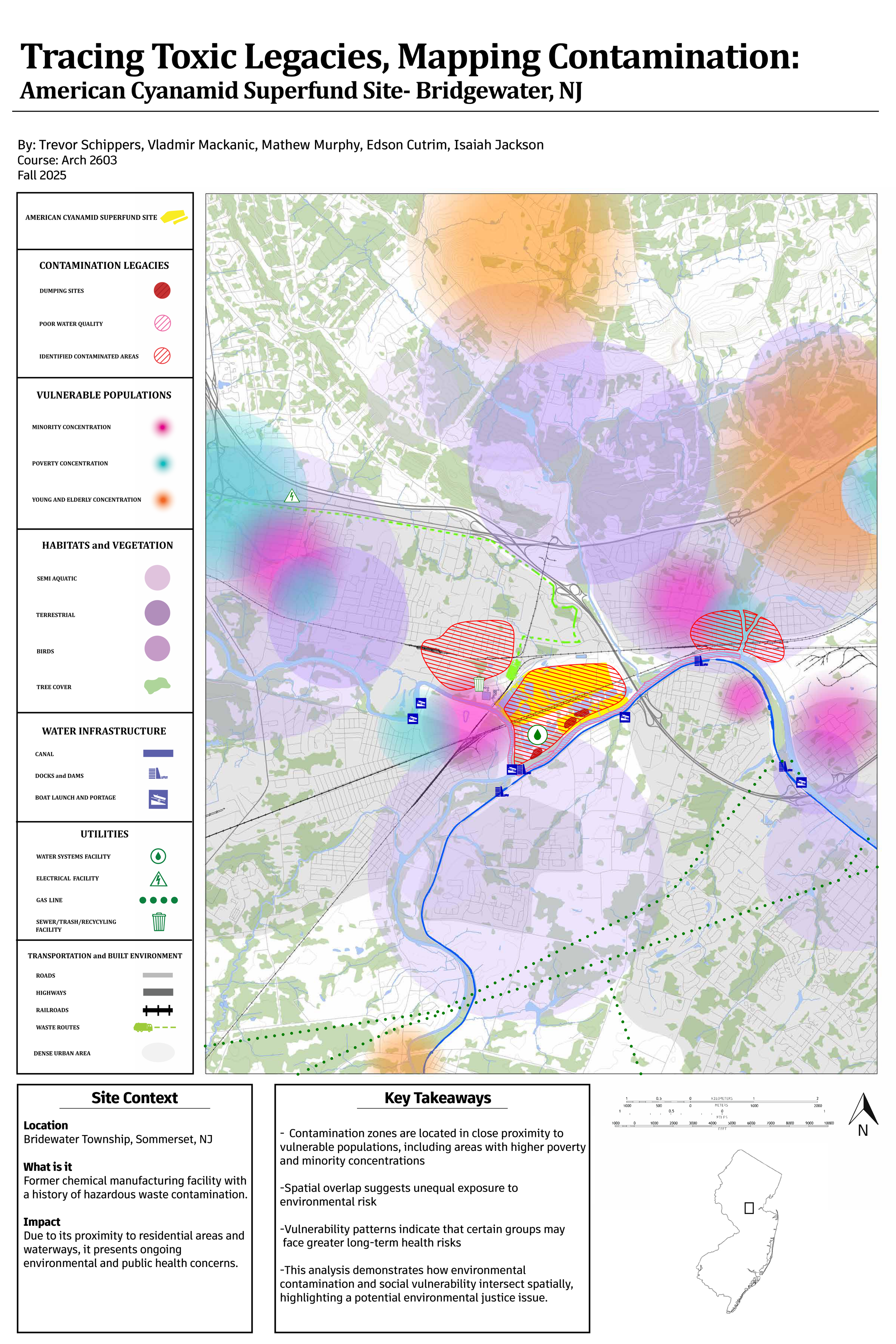
This mapping research, conducted in ARCH 2603, investigates the long-term environmental and spatial impacts of hazardous material dumping at the American Cyanamid Superfund Site along the Raritan River in Bridgewater, New Jersey. The project visualizes how industrial contamination continues to shape ecological systems, infrastructure, and surrounding communities.The map highlights key spatial and environmental data, including demographic patterns, land use, water infrastructure, transportation routes, marine and terrestrial ecosystems, vulnerable populations, documented dumping locations, and identified zones of poor water quality and contamination.The intent of this piece is to inform viewers about the connected relationship between industrial infrastructure, environmental degradation, and community vulnerability, while demonstrating how mapping can serve as a critical tool for exposing hidden systems of contamination and spatial injustice.